Severe thunderstorms carrying damaging straight-line winds are expected to move through Clinton, Carroll and Boone Counties late Sunday and into early next week, independent meteorologist Chad Evans said Friday, even as he outlined a long-range outlook pointing toward one of the warmest Decembers on record.
Evans, who forecasts for the North-Central Indiana area including Clinton, Tippecanoe, Boone, Carroll and White counties, joined WILO’s “Party Line” program to discuss the coming days’ weather as well as his extended outlook through the winter. The interview also touched on his background in agronomy, the technology behind modern forecasting, and how wildfire smoke and even rocket launches can subtly reshape the atmosphere.
Storms Expected Late Weekend Into Next Week
Evans said Saturday should remain dry, and most of Sunday will hold up as well, but conditions will turn stormy later Sunday and carry into early next week.
“Hopefully we can squeeze Saturday in just fine, which I think we will,” Evans said. “But it is going to get stormy late weekend and then early next week.”
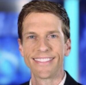
Evans said the region should brace for muggy, oppressive conditions Sunday through Tuesday, with highs reaching the low 90s ahead of the storms. The system itself, he said, will arrive as lines of storms moving in from Iowa rather than isolated supercells.
“These are the damaging straight-line wind events that come in from the northwest,” Evans said. “We’ve got to watch those for about three days.” He added that rainfall totals will vary sharply across the coverage area, with some spots receiving more than two and a half inches while others see comparatively little.
From Farm Kid to Forecaster
Evans said his interest in weather traces back to growing up in a farming community in southwest Indiana, where open skies made daily weather-watching part of life.
“When you grow up around farming and you’re around those open spaces and around nature and ag every day, your whole world revolves around weather,” Evans said. “It started around seven years old. It was the storms, the wind storms, the snowstorms — everything we got was really fascinating to me.”
Wary of the math and physics behind meteorology, Evans instead pursued agronomy through a Purdue transfer program before realizing during an internship that he was watching the sky more than his crops. He has now worked in weather for over 23 years.
“To this day, farmers and the ag community mean so much to me,” he said. “When you’ve got millions of dollars on the line, every decision counts — it can mean the difference between a really good yield and a really bad yield.”
A Hyper-Local Approach
Evans said he has turned down requests to expand his forecast into Illinois or other counties, preferring to keep his coverage tightly focused.
“I really truly want to be local, local, local,” he said. “I don’t want to do statewide weather, I don’t want to do a Midwest weather. I serve the people of Clinton and Tippecanoe and Boone and Carroll and White counties.” That narrow focus, he said, lets him track local idiosyncrasies in storm tracks that broader regional forecasts miss.
Evans also described a demanding daily schedule since leaving television. “A lot of my days have not changed after leaving television — I’m just doing weather in a different way,” he said. “I think I work more now than I ever did in TV, because I cover every shift.”
Smoke, Satellites and the Science Behind the Forecast
Evans said wildfire smoke can suppress storm development by drying and warming the atmosphere, but under certain conditions low-level smoke has been linked to elevated tornado risk, including a 2011 outbreak in Alabama. He also pointed to research from the days following the September 11 attacks, when grounded aircraft and the absence of contrails caused nighttime temperatures to drop noticeably nationwide — evidence, he said, of how emissions from aircraft, rockets and satellites can subtly influence local weather.
On longer-range patterns, Evans described how El Niño and La Niña interact with other atmospheric drivers, likening the effect to complementary basketball teammates. “El Niño and a lot of these other teleconnections have a synergy,” he said. “Once you know the MJO (Madden-Julian Oscillation) and El Niño are working together, that could bring us a record warm December. But if the MJO is in a different phase, El Niño doesn’t have the same influence.”
Month-by-Month Outlook
Evans offered a detailed extended forecast for the remainder of the year:
• Late July: Storms and locally heavy rain move through late this weekend into early next week, with muggy, oppressive conditions Sunday–Tuesday and highs near 90.
• Late July into early August: Cooler and less humid, without significant heat.
• Mid-to-late August: A stormy, muggy-to-oppressive stretch returns after the midpoint of the month, followed by cooler, drier conditions with one more possible push into the mid-90s in late August or early September.
• Mid-September: Turns cooler and potentially wetter.
• Late October and November: Trending warm and dry.
• December: Warm and drier than normal, with a strong chance of one of the warmest Decembers on record — though Evans cautioned some unseasonable severe weather could still sneak in. No white Christmas is expected.
• January: Warmer than normal with below-normal rainfall and snowfall; the season’s first significant snow is more likely in January than December.
• February: Warmer than normal with slightly more rainfall but still below-normal snow.
Evans said growers can expect at least occasional heavy rain events through the growing season, though he stopped short of naming an exact date for the next major soaking rain.
Weather Coverage Beyond the Forecast
Evans’ extended interview aired on WILO’s “Party Line,” part of the station’s regular attention to weather programming. WILO also provides live severe weather coverage during active warnings, and Evans said he posts real-time updates on Facebook “when it’s hitting the fan and we’re getting warnings.” Listeners can also follow his longer-range, agriculture-focused forecasts on Substack and YouTube.
Reflecting on the conversation, Evans thanked the community he serves. “I love the people of Clinton County and Boone County and all of my growers out there,” he said. “I appreciate every one of you, and it means the world to me to get to talk with everybody today.”
Hosts Cindy Loveless and Melissa Miller invited Evans to come back on WILO from time to time to update listeners on the expansive and important weather topics affecting Clinton, Carroll and Boone County, which may include forecasting, ag weather news and markets, plants, hay harvests, gardens, landscaping and much more.