
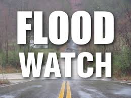
 The National Weather Service in Indianapolis has issued a Flood Watch for portions of central Indiana, east central Indiana, north central Indiana, south central Indiana, southwest Indiana and west central Indiana from Friday evening through Saturday evening.
The flood watch is for the following areas, in central Indiana, Bartholomew, Boone, Clinton, Hamilton, Hancock, Hendricks, Howard, Johnson, Madison, Marion, Morgan, Shelby, and Tipton. In east central Indiana, Delaware, Henry, and Randolph. In north central Indiana, Carroll. In south central Indiana, Brown and Monroe. In southwest Indiana, Daviess, Greene, Knox, Martin, and Sullivan. In west central Indiana, Clay, Fountain, Montgomery, Owen, Parke, Putnam, Tippecanoe, Vermillion, Vigo, and Warren.
Rain, possibly heavy at times, will fall tonight into Saturday. Total rainfall amounts of 2 to 4 inches with locally heavier amounts are possible. There remains some uncertainty on where the heaviest rain will fall.
The forecast rainfall amounts would cause minor to moderate flooding of area rivers and streams. Higher rainfall amounts would lead to isolated major river flooding. In addition, low lying areas may flood due to the heavy rain.
A Flood Watch means there is a potential for flooding based on current forecasts. You should monitor later forecasts and be alert for possible Flood Warnings. Those living in areas prone to flooding should be prepared to take action should flooding develop.