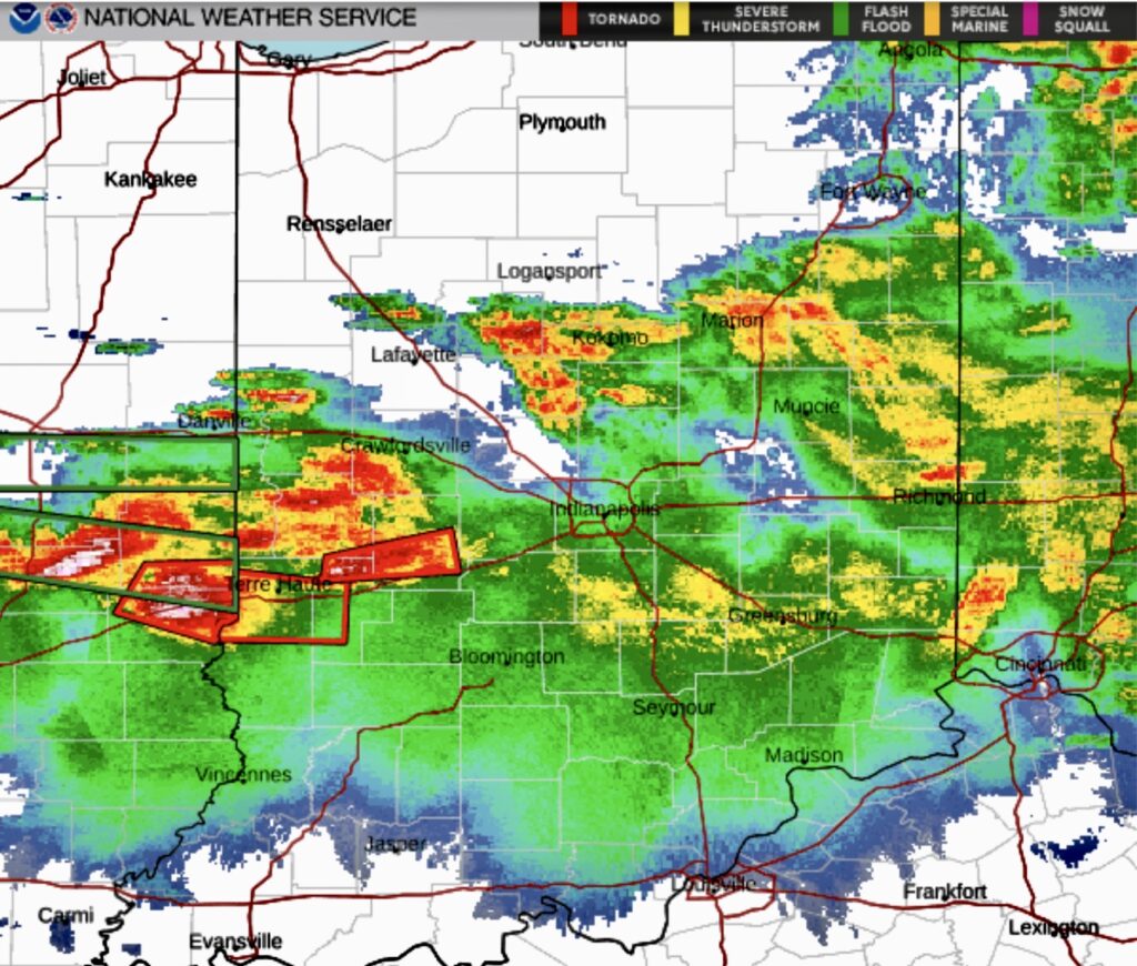
Wednesday evening forecasts signaled the potential for significant storm damage across the WILO listening area. A tornado watch remains in effect until 1 a.m. Thursday for much of Indiana.
The most severe weather ultimately tracked through central and southern Illinois, particularly in the Decatur and Cole County area, where reports included 80 mph straight-line winds, tornado activity, and large hail.
Closer to home, Clinton, Carroll, and Boone counties avoided both tornado warnings and severe thunderstorm warnings Wednesday evening. At the Frankfort/Clinton County Airport, winds were recorded between 14 and 28 knots, or roughly 16 to 32 miles per hour.
The WILO weather team remained on standby throughout the evening, prepared to provide uninterrupted severe weather coverage on WILO 96.9 FM, 1570 AM, and Boone 102.7 FM if conditions had worsened.
Rainfall totals across the region varied widely, ranging from less than one inch to more than four inches in parts of Illinois. A flood watch remains in effect for the WILO broadcast area until 4 a.m. Thursday.
Most of tonight’s serious storm damage appears to be in parts of Illinois, with mainly heavy rain, some flooding risk, and lighter wind impacts so far in Indiana.
Illinois
• Strong storms produced tornadoes, damaging straight-line winds, large hail, and flooding in portions of the state.
• Reports this evening and earlier this week include destroyed or heavily damaged homes, downed trees and power lines, and widespread power outages in several communities.
Indiana
• Indiana has seen severe storms in recent days with tornado damage in northwest and northern parts of the state, where hundreds of buildings were damaged and many trees and lines were downed.
• Tonight’s line has mainly brought heavy rain and localized flooding risk so far, with flood watches in effect in parts of the region and some power outages where storms have been strongest.
Regional impacts
• Across Illinois and Indiana, the broader outbreak has produced multiple confirmed tornadoes, large hail up to several inches in diameter, and wind gusts over 70 mph, leading to roof, vehicle, crop, and infrastructure damage.
• Utilities have reported tens of thousands of customers without power at times during this pattern, and cleanup is ongoing in several hard-hit communities.