
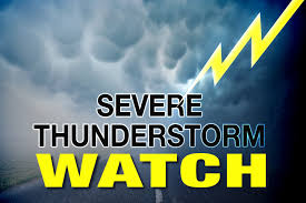
 The National Weather Service in Indianapolis has issued a Severe Thunderstorm Watch for several Indiana counties, including Clinton County, until 9 p.m. Wednesday (tonight).
Besides Clinton, other affected counties are Adams, Bartholomew, Blackford, Boone, Brown, Carroll, Clay, Daviess, Dearborn, Decatur, Delaware, Fayette, Fountain, Franklin, Grant, Greene, Hamilton, Hancock, Hendricks, Henry, Howard, Jackson, Jay, Jennings, Johnson, Knox, Lawrence, Madison, Marion, Martin, Monroe, Montgomery, Morgan, Owen, Parke, Putnam, Randolph, Ripley, Rush, Shelby, Sullivan, Tippecanoe, Tipton, Union, Vermillion, Vigo, Warren, Wayne and Wells.
This includes the cities of Delphi, Flora, Williamsport, West Lebanon, Lafayette, West Lafayette, Frankfort, Kokomo, Attica, Covington, Veedersburg, Crawfordsville, Lebanon, Zionsville, Tipton, Fishers, Carmel, Noblesville, Anderson, Muncie, Winchester, Clinton, Newport, Rockville, Greencastle, Plainfield, Brownsburg, Danville, Indianapolis, Greenfield, Cumberland, New Castle, Terre Haute, Brazil, Clay City, Spencer, Martinsville, Mooresville, Greenwood, Franklin, Shelbyville, Rushville, Sullivan, Linton, Bloomfield, Bloomington, Nashville, Columbus, Greensburg, Vincennes, Washington, Loogootee, Shoals, Bedford, Mitchell, Seymour, Brownstown and North Vernon.
Scattered thunderstorms are expected today and tonight. Some of these storms may be strong to severe with damaging winds, large hail, heavy rainfall and lightning. Best chances for severe storms will be from 4-11 p.m.