
The National Weather Service has issued a flood watch for Clinton, Boone and Carroll counties for 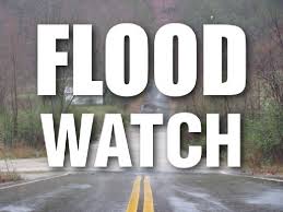 today, Tuesday, April 2 until 2 p.m.
The flood watch was issued at 8 p.m. Monday evening and is expected to persist until 2 p.m. on Tuesday. The severity has been issued as severe with significant threat to life or property for all of Central Indiana during the timeframe of the watch as two inches of rain is expected across the region throughout the timeframe.
The National Weather Service also stated that excessive runoff may result in the flooding of rivers, creeks, streams and other low-lying and flood-prone locations.
Showers and thunderstorms are expected to continue through the overnight into Wednesday where the National Weather Service is expecting some showers with the possibility of snow as temperatures drop from highs in the mid-60’s today to mid-30’s overnight.
The service also issued a statement regarding the severity of the storms expected Tuesday, stating that severe thunderstorms are expected toward daybreak and may include heavy rainfall alongside breezy winds, and chances of rain are around 100 percent for the region.