
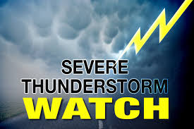
 The National Weather Service in Indianapolis has issued a Severe Thunderstorm Watch for central Indiana, including Clinton County, until 8 p.m. Sunday.
Besides Clinton, other affected counties include Bartholomew, Boone, Brown, Carroll, Clark, Clay, Crawford, Daviess, Decatur, Delaware, Dubois, Floyd, Fountain, Greene, Hamilton, Hancock, Harrison, Hendricks, Henry, Howard, Jackson, Jefferson, Jennings, Johnson, Lawrence, Madison, Marion, Martin, Monroe, Montgomery, Morgan, Owen, Parke, Putnam, Rush, Shelby, Sullivan, Tippecanoe, Tipton, Vermillion, Vigo and Warren.
This includes the cities of Frankfort, Delphi, Flora, Williamsport, West Lebanon, Lafayette, West Lafayette, Kokomo, Attica, Covington, Veedersburg, Crawfordsville, Lebanon, Zionsville, Tipton, Fishers, Carmel, Noblesville, Anderson, Muncie, Winchester, Clinton, Newport, Rockville, Greencastle, Plainfield, Brownsburg, Danville, Indianapolis, Greenfield, Cumberland, New Castle, Terre Haue, Franklin, Shelbyville, Rushville, Sullivan, Linton, Bloomfield, Loogootee, Shoals, Bedford, Mitchell, Seymour, Brownstown and North Vernon.
Thunderstorms are expected across the area today, and some of those could be severe. Heavy rain is possible with any storm. Increasingly warm and humid. Heavy rain causing flooding, damaging winds, hail and lightning are all possible. Heat indices peaking into the low 90s this afternoon, mainly south. The best chance for severe weather will be from mid afternoon into the evening.